


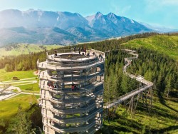
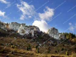
Litmanová, walking into the nature
Accommodation Litmanová
List of tourist attractions Litmanová
Find Walking into the nature in the surrounding area of Litmanová:
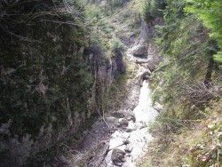

Treetop walk Bachledka
The Treetop walk Bachledka islocated in Bachledova Valley in Zdiar. It offers views of the Belianske Tatras from the 32 meter high tower and the unique scenery of Pieniny and Zamaguria. The walkway is 1.8 km long with an elevation of 300 m. A route with a length of more than 600 m will lead you through the species-rich forest, where you can expect various surprises and lessons. Here you will find a wealth of information boards, from which you will find interesting information about the fauna, flora...
Botanical Garden - Exposition Of Tatra Nature
Botanical garden is situated on the northern-eastern boundary of Tatranská Lomnica in High Tatras, next to the Hotel Sorea Titris. It is located on the territory of 3,2 ha. The visitor can see here 270 types of Tatra plants growing on various biotopes, some of them are possible to be purchased in form of seedlings or seeds. In the Exposition of Tatra nature also a small geological area can be found and a memorial place devoted to those who enforced and realized the idea of Tatra National Park. Open...
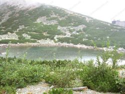
SKALNATÉ PLESO
Skalnaté pleso is located in the Tatras below the southern slopes of Lomnický štít in Skalnata dolina. You will find the lake at an altitude of 1754 m above sea level. m. At the ball there is a valley station of the cable car to Lomnický štít, a chairlift to Lomnický sedlo, the upper station of the cable car that runs from Tatranská Lomnica to Skalnaté pleso. In the hot and dry period, the lake is without water, because the impermeability of its bottom was disrupted during the construction...
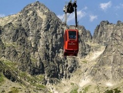
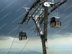
Cable car to Lomnnicky peak
Discover one of the highest peaks of the High Tatras! Lomnicky Stit with an altitude of 2634 meters is a great destination for the whole family. The mountain peak rises above the clouds and provides spectacular views to all visitors. Enter the area of silence, where you can enjoy a wonderful view on the café terrace alongside coffee specialties. The lower station is located at Skalnate Pleso, from where you can take the red cable car to the Lomnicky peak. The cable car exceeds 855 meters of elevation...

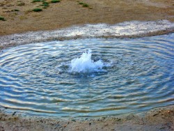
Sivá Brada (Mineral spring)
Sivá Brada is a travertine mound located near the town of Spišské Podhradie to the west. At its top, a mineral spring springs, creating a small lake with a diameter of 3 m, in the middle of which a continuously bubbling mineral water springs. Other mineral springs spring up in the area. Small cascades are formed from the draining water and thus troughs of small streams are created here. The travertine mound has been growing for about 10,000 years with such slow mineral deposition. In 1675, a baroque...

Great Hincovo Tarn
Veľké Hincovo pleso is the largest and deepest lake in Slovakia. It has an area of 20.08 ha, a depth of 53.7 m, its length is 740 m and a width of 370 m. It is located in the Tatras in the Hincov basin at an altitude of 1946 m above sea level. m. On average, 270 days a year are covered with ice. The Hincov stream flows out of the lake, which after the connection with Krupa forms the Poprad river. In the west, the walls of Kôprovské štít rise above the ball, in the north of Čubrina and Velký...
Our tips
37.50 €

32.50 €
28.50 €

HEPEX Slovakia s.r.o.
All rights reserved.
Webdesign, SEO optimalizácia
by www.Pixa.sk