


Demänovská Dolina, walking into the nature
Accommodation Demänovská Dolina
List of tourist attractions Demänovská Dolina
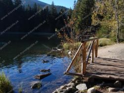
Vrbické Mountain Lake
Lake Verbicé (Slovak: Vrbické pleso) is one of the largest lakes in the Low Tatras, which has survived from the Ice Age. It is located at an altitude of 1113m above sea level in the western part of the Demänovská Dolina. The surface of the lake is 0.69 ha, the deepest point is 8 m deep, 115 m long and 62 m wide. Lake Moréna, formed by the retreat of glaciers from the northern slopes of the Chopok Mountains. The Otupnianka River flows from the lake, so the maintenance of a constant water level is regulated by dams. In terms of its origin, it is most similar to lakes in the High Tatras. Lake...
Find Walking into the nature in the surrounding area of Demänovská Dolina:

Lookout tower Pavčina Lehota

Lookout tower Svätojánska
Hrádocké Arborétum
Hrádok Arboretum is located in the cadastral area of Liptovský Hrádok at an altitude of 650 m directly in the northern part of the city surrounded by housing estates. Despite its small size, the Hrádek Arboretum is currently unique in Europe. It is the highest situated arboretum in Central Europe and contains the fourth largest dendrological collections in Slovakia. The arboretum contains unique taxa from our and world dendroflora, which are listed in the Red Books of several states, and which...
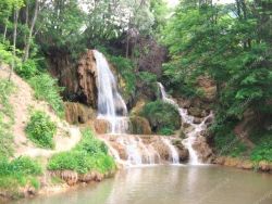
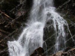
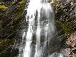
Lúčanský vodopád
photo: www.e-obce.sk

Forest Open Air Museum Vydrovo
Forestry museum is situated in Vydrovská valley in the region of Horehronie, about 1 km from the Čierny Balog. Here, in the beautiful forest surrounding of Veporské Hills, you can see various exhibits that got you acquainted with the forestry - with its past and present. 3 km long route, called the Walk of Forestry Time currently consists of 75 stops. They'll share the importance of forests in our lives. You will learn what all is necessary for the conservation and protection of forests. The...

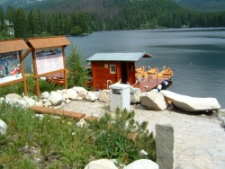
Boating on Štrbské Pleso
Boating at Štrbské pleso was renewed in 2008 after 30 years. Boat rental is available daily from 9:00 am to 6:00 pm during the summer. For clients there are 7 wooden stylish boats, which are built at the pier. There is also the possibility of using the services of a private rower.

Štrbské pleso (Lake)
Štrbské pleso is a picturesque mountain lake of glacial origin and a top tourist destination in the High Tatras, Slovakia. It is the second largest glacial lake on the Slovak side of the High Tatras, after Hincovo pleso.

Sedačková lanovka Štrbské Pleso - Solisko

Great Hincovo Tarn
Veľké Hincovo pleso is the largest and deepest lake in Slovakia. It has an area of 20.08 ha, a depth of 53.7 m, its length is 740 m and a width of 370 m. It is located in the Tatras in the Hincov basin at an altitude of 1946 m above sea level. m. On average, 270 days a year are covered with ice. The Hincov stream flows out of the lake, which after the connection with Krupa forms the Poprad river. In the west, the walls of Kôprovské štít rise above the ball, in the north of Čubrina and Velký...
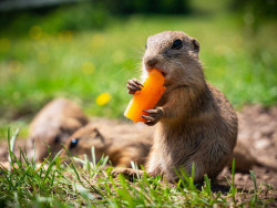
Ground squirrel area Muránska plain
This meadow full of friendly gophers is located in the middle of the Muránská plain, 2 km northeast of the village of Muráň, in the valley below the Murán castle. A huge ground squirrel colony lives here, which is the largest in Slovakia. The ground squirrel is one of the few places in the country where you can observe ground squirrels in the wild at close range. Ground squirrels from Muránská luka are very friendly and used to curious tourists. For a small treat, they are very happy to...
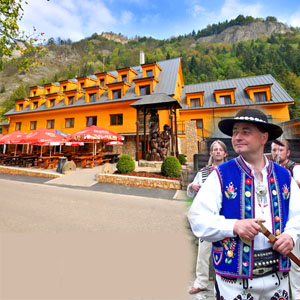
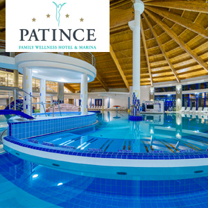
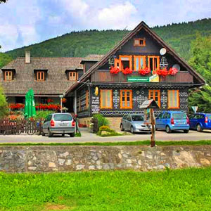
Our tips
44.50 €
69.50 €
28.00 €
HEPEX Slovakia s.r.o.
All rights reserved.
Webdesign Pixa.sk
Change cookie settings