


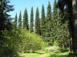
Liesek, walking into the nature
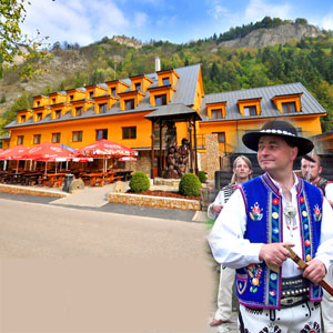
Accommodation Liesek
List of tourist attractions Liesek
Find Walking into the nature in the surrounding area of Liesek:
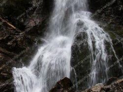

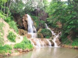
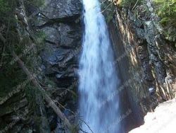
Lúčanský vodopád
photo: www.e-obce.sk

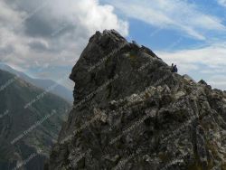
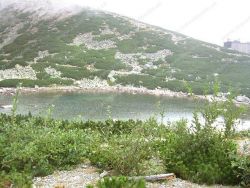
Great Hincovo Tarn
Veľké Hincovo pleso is the largest and deepest lake in Slovakia. It has an area of 20.08 ha, a depth of 53.7 m, its length is 740 m and a width of 370 m. It is located in the Tatras in the Hincov basin at an altitude of 1946 m above sea level. m. On average, 270 days a year are covered with ice. The Hincov stream flows out of the lake, which after the connection with Krupa forms the Poprad river. In the west, the walls of Kôprovské štít rise above the ball, in the north of Čubrina and Velký...
Hrádocké Arborétum
Hrádok Arboretum is located in the cadastral area of Liptovský Hrádok at an altitude of 650 m directly in the northern part of the city surrounded by housing estates. Despite its small size, the Hrádek Arboretum is currently unique in Europe. It is the highest situated arboretum in Central Europe and contains the fourth largest dendrological collections in Slovakia. The arboretum contains unique taxa from our and world dendroflora, which are listed in the Red Books of several states, and which...

Sedačková lanovka Štrbské Pleso - Solisko

Štrbské pleso (Lake)
Štrbské pleso is a picturesque mountain lake of glacial origin and a top tourist destination in the High Tatras, Slovakia. It is the second largest glacial lake on the Slovak side of the High Tatras, after Hincovo pleso.
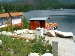
Boating on Štrbské Pleso
Boating at Štrbské pleso was renewed in 2008 after 30 years. Boat rental is available daily from 9:00 am to 6:00 pm during the summer. For clients there are 7 wooden stylish boats, which are built at the pier. There is also the possibility of using the services of a private rower.
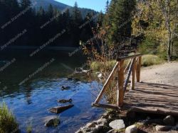
Vrbické Mountain Lake
Lake Verbicé (Slovak: Vrbické pleso) is one of the largest lakes in the Low Tatras, which has survived from the Ice Age. It is located at an altitude of 1113m above sea level in the western part of the Demänovská Dolina. The surface of the lake is 0.69 ha, the deepest point is 8 m deep, 115 m long and 62 m wide. Lake Moréna, formed by the retreat of glaciers from the northern slopes of the Chopok Mountains. The Otupnianka River flows from the lake, so the maintenance of a constant water level...
SKALNATÉ PLESO
Skalnaté pleso is located in the Tatras below the southern slopes of Lomnický štít in Skalnata dolina. You will find the lake at an altitude of 1754 m above sea level. m. At the ball there is a valley station of the cable car to Lomnický štít, a chairlift to Lomnický sedlo, the upper station of the cable car that runs from Tatranská Lomnica to Skalnaté pleso. In the hot and dry period, the lake is without water, because the impermeability of its bottom was disrupted during the construction...
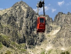
Cable car to Lomnnicky peak
Discover one of the highest peaks of the High Tatras! Lomnicky Stit with an altitude of 2634 meters is a great destination for the whole family. The mountain peak rises above the clouds and provides spectacular views to all visitors. Enter the area of silence, where you can enjoy a wonderful view on the café terrace alongside coffee specialties. The lower station is located at Skalnate Pleso, from where you can take the red cable car to the Lomnicky peak. The cable car exceeds 855 meters of elevation...

Our tips
39.50 €
32.50 €
29.50 €

HEPEX Slovakia s.r.o.
All rights reserved.
Webdesign, SEO optimalizácia
by www.Pixa.sk